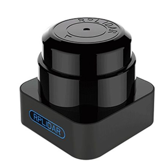
Courtesy: ROBU
In today’s growing tech worldLIDARs plays far-reach role and has changed our life with extensive area of applications. Its precise data acquisition and dynamic scanning range addedthe eagle eyes in small robots on grounds to giant ships in water and Airplane in skies. According to its diverse applications, LIDARs are being designed and manufactured to add more accuracy and precision to the world of automation, as a result of it if we search for application of LIDAR,it comes to the bottomless results..!
The word LIDAR is technically an acronym. However, just like its predecessor’s sonar and radar, LIDAR has become so common that it is often simply written as a word “Lidar”. While LIDAR was invented soon after the first lasers in the 1960s, its becamecommoly used in aerospace only and didn’t appeared in general purpose applications until the 1970s. Over the period with its Commercial and consumer application it has added significant advancement in all related field by today’s standards. These sensor module were robust enough to authenticate the growing belief that LiDAR technology is the way of the future.
How Does LIDAR Work?
The working principle of Light Detection and Ranging system is really quite simple. A LIDAR sensor mounted on an Application or Vehicle. It generates Laser pulse train, which sent to the surface/target to measure the time and it takes to return to its source. The actual calculation for measuring how far a returning light photon has traveled to and from an object is calculated by
Distance = (Speed of Light x Time of Flight) / 2
Accurate distances are then calculated to the points on the ground and elevations can be determined along with the ground surface buildings, roads, and vegetation can be recorded. These elevations are combined with digital aerial photography to produce a digital elevation model of the earth.
Types of LIDAR:
There are two basic types of Lidar: Airborne and Terrestrial.
A] Airborne
As the name suggests, Airborne LiDARs are mounted on top of a helicopter or drone. The light is first emitted towards the ground and then it moves towards the sensor. Airborne LiDAR is further classified into topographic and bathymetric.
- Topographic LiDAR
It is used mainly in monitoring and mapping topography of a region. So it has its applications in geomorphology, urban planning, landscape ecology, coastal engineering, survey assessment etc.
- Bathymetric LiDAR
Bathymetric LiDARs are used in measuring the depth of water bodies. In a bathymetric LiDAR survey, the infrared light is reflected back to the aircraft from the land and water surface, while the additional green laser travels through the water column. Bathymetric information is crucial near coastlines, in harbors, and near shores and banks. Bathymetric information is also used to locate objects on the ocean floor.
B] Terrestrial LiDAR
Terrestrial LIDAR can be installed either on a tripod or on a moving vehicle. It collects data points that help in the highly-accurate identification of data. This has its application in surveying and creating 3D Modeling. Terrestrial LiDAR can be either Mobile or Static
- Mobile: It is mostly used to analyze infrastructure and observe roads. Mobile LiDAR systems mostly include sensors, camera and GPS.
- Static: Static LiDAR is more portable, handy to use. It collects cloud points from a fixed location and is used in mining and archaeology.
Lets have a look at some types of LIDAR sensors popular in 2020
Benewake CE30-A Solid State 3D LIDAR Wide FOV Obstacle Avoidance Version.
CE30-A Solid State 3D LIDAR Wide FOV LiDAR Sensor is a solid-state infrared LiDAR which is developed based on the ToF principle. Equipped with its special hardware design, it could complete the measurement of wide horizontal FOV and output the grey and depth information at the same time
Tech Overview:
- Model: CE30-A
- Detecting Range:1~4m
- Ranging Resolution:1cm
- Repeatability:≤3cm
- Accuracy:≤5cm
Benewake TF350 Industrial Single-Point Ranging LiDAR (350m)
TF350 is an industrial single-point ranging LiDAR, made for intelligent transportation, industrial drones, automobiles, industry, and other applications. TF350 belongs to the same series as TF03, but its range is much longer with a measurement frequency of up to 10KHz. multiple communication interfaces are supported in its IP67 high-intensity casing.
Tech Overview:
- Range: 350m
- Communication: UART, CAN
- Operating frequency: 1 Hz to 1000 Hz
- The illumination wavelength: 905 nm
- Degree of protection: IP67
Benewake TF03 180M Long Distance Laser Lidar/Rangefinder for Drones, UAV UAS Robots
Benewake TF03 180M Long Distance Laser Lidar/Rangefinder for Drones as a single-point long distance LiDAR in accordance with the industrial level; mainly targets the intelligent transportation system, industrial UAV, automotive and other industrial applications.
Tech Overview:
- Wide range, as far as 180m.
- IP67 high-strength bodywork and high reliability.
- High-speed measuring up to 10KHz, high repeated accuracy.
- Excellent highlight interference, able to be used outdoors.
TF02-Pro LIDAR Distance Ranging Sensor FOR DRONES UAV UAS Robots (40M) IP65 LiDAR
TF02-Pro is a single-point ranging LiDAR based on the TF02 upgrade. The performance and accuracy of different reflectivity are improved, it can achieve stable, accuracy, sensitive and high-frequency range detection
Quick Overview:
- The range up to 40 meters
- High frame rate(up to 100Hz)
- Low power consumption
- Higher Accuracy and frequency.
- Richer Interface – UART/I2C/IO
TF-LUNA Micro LiDAR Distance Sensor for IoT ITS (8M)
TF-Luna is a single-point ranging LiDAR, based on the TOF principle. With unique optical and electrical design, it can achieve stable, accurate and highly sensitive range measurement. The product is built with algorithms adapted to various application environments and adopts multiple adjustable configurations and parameters so as to offer excellent distance measurement performances in complex application fields and scenarios.
Quick Overview:
2. Operating Range is up to 8m
3. Distance Resolution = 1cm
4. Power Consumption≤0.35W
5. Frame Rate: 1-250Hz(Default 100Hz)
6. FOV: 2° Weight: <=5g
Slamtec Mapper M1M1 ToF Laser Scanner Kit – 20M Range
The Slamtec Mapper has two models with a detection range of 20m and 40m. It can easily map for home scenes or commercial, light industrial scenes. In the handheld mode, the built-in 9 degrees freedom inertial navigation system of the M1M1 can eliminate the bumps and shake caused by walking and exert super high map construction performance. The M1M1 can detect up to 20 meters with the 5cm resolution and the re-localization accuracy is less than 0.02m.
Tech Overview:
-
- Distance Range(m):20
- Sample Rate:7K
- Max mapping area:300m x 300m
- Resolution(cm):5
- Data refresh rate(Hz):8
RP LIDAR A3M1 360°Laser Range Scanner-25 Meter Range
The RPLIDAR A3M1 is the next generation low cost 360 degrees 2D laser scanner (LIDAR) solution developed by SLAMTEC. It can take up to 16000 samples of laser ranging per second with high rotation speed. And equipped with SLAMTEC patented OPTMAG technology, it breakouts the life limitation of traditional LIDAR system so as to work stably for a long time.
Tech Overview:
- Ranging 16000 Times per Second
- 25 Meters Range Radius
- Indoor and Outdoor Availability
- 360 Degree Omnidirectional Laser Range Scanning
RPLiDAR S1 Portable ToF Laser Scanner Kit – 40M Range
RPLiDAR S1 adopts TOF(Time of Flight) ranging technology, which guarantees the ranging resolution not changing with the distance, the ranging resolution is till stable and accurate. RPLiDAR S1 has 9200 laser ranging sampling capabilities per second, weather-resistant, lightweight, and enclosed cover. It is best for SLAM Research and Environmental Scanning and 3D reconstruction.
The RPLiDAR S1 adopts the low power infrared laser light as its light source and drives it by modulated pulse. It reaches Class 1 Laser Safety Standard which can ensure its safety to human eyes.
Application Scenarios: Works well both in indoor and outdoor environment, reliable resistance to daylight
Tech Overview:
- Distance Range(On Black Objects):10m-40m
- Sample Rate: 9200 times per second
- Sample Frequency: Typical value: 10Hz
- Band Rate: 256000bps
RP LIDAR A2M8 360 degrees Laser Range Finder-12 Meter Range
The RP LIDAR A2M8 360 degrees Laser Range Finder-12 Meter Range is the next generation low cost 360 degrees 2D laser scanner (LIDAR) solution. It can take up to 8000 samples of laser ranging per second with high rotation speed. And equipped with SLAMTEC patented OPTMAG technology, it breakouts the life limitation of traditional LIDAR system so as to work stably for a long time.
RPLIDAR A2M8 is the enhanced version of 2D laser range scanner(LIDAR). The system can perform 2D 360 degree scan within a 12-meter range The generated 2D point cloud data can be used in mapping, localization and object/environment modeling. The typical scanning frequency of the RPLIDAR A2 is 10hz (600rpm). Under this condition, the resolution will be 0.45°. And the actual scanning frequency can be freely adjusted within the 5-15hz range according to the requirements of users.
Tech Overview:
- Scanning Range: 12M-18M Radius
- Detection Range: 12M Radius
- 360-degree laser range scanning
- Low Noise, Brushless Motor New Non-contact Drive
RPLiDAR A1M8 360 Degree Laser Range Finder – 6m (Radius Range)
RPLiDAR A1M8 360 Degree Laser Range Finder – 6m (Radius Range) is a low cost 360-degree 2D laser scanner (LIDAR) solution developed by SLAMTEC. The system can perform a 360-degree scan within a 6-meter range. The produced 2D point cloud data can be used in mapping, localization and object/environment modeling.
RPLIDAR A1’s scanning frequency reached 5.5 Hz when sampling 360 points each round. And it can be configured up to 10 Hz maximum. RPLIDAR A1 is basically a laser triangulation measurement system. It can work excellently in all kinds of indoor and outdoor environments without sunlight
Tech Overview:
- Distance Range (Radius): 0.15m to 6m, white objects (Diameter Range – 12m)
- Angular Range: 0 ~ 360º
- Sample Frequency: 2000 – 2010Hz
- Scan Rate: 1 ~ 10Hz, Typical 5.5Hz
TFMini Plus LiDAR Distance Sensor for Drones Robots IoTITS Smart Detection (12m)
TFMini Plus LiDAR Distance Sensor for Drones Robots IoT ITS Smart Detection (12m) is a milestone of Benewake in the process of promoting the cost-effective -LiDAR. Apart from low-cost, small-size and low-power-consumption, TFmini Plus also improves the frame rate, introduces IP65 enclosures and optimizes various compensation algorithms. These new characters greatly expand the application fields and scenarios of TFmini Plus.
Tech Overview:
- Low-power-consumption
- Improves the frame rate
- IP65 enclosures
- Optimizes various compensation algorithms.
- Operating Range: 0.1m ~ 12m
TFMini-S Micro LiDAR Distance Sensor for Drones UAV UAS Robots (12m)
TFmini-S is a single-point ranging LiDAR based on the TFmini upgrade. The blind zone is shortened from 30cm to 10cm, the outdoor performance and accuracy of different reflectivity are improved. The distance range is not disturbed by ambient light, which can be consistent with the indoor range and the accuracy is further optimized. The error performance at 10% reflectivity approaches the background of 90% reflectivity, and the interface supports UART and I2C switching at any time. It can achieve stable, accuracy, sensitive and high-frequency range detection.
Tech Overview:
- Operating Range is 0.1 ~ 12m
- Frame Rate is 10 – 1000Hz
- Operating Temperature is 0℃~60℃
- Communication Interface – UART
LIDAR is such an extensive topic that it would not be possible to cover everything in one post. Look out for other posts on Lidar in future


